


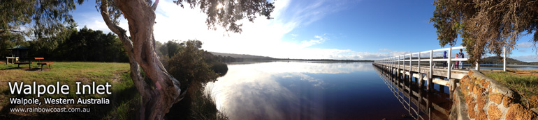
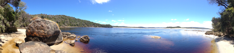
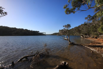
Walpole Inlet
Below you'll find a MAP of the Walpole and Nornalup Inlets and the Channels on the Knoll Scenic Drive Map.
Stop at the Walpole inlet before visiting the nearby Giant Tingle Tree which offers you a look at the worlds oldest living eucalypt. Walpole - Nornalup National Park is filled with Tingle, and is a wonderful woodland experience.
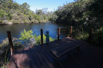
Circular Pool is also located nearby. Perfect for paddling in the waterfalls and rock pools of the Wilderness Area. The cachment for the Walpole and Nornalup Inlets occupies a large proportion of the Walpole-Nornalup National Park.
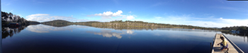
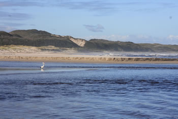
The Walpole Inlet is the heart of Walpole and everything that surrounds the town and surrounds. Be sure to stop for a few minutes and relax beside the beautiful Walpole Inlet.
There are boat ramps and water access points all around the inlet. Enquire of the Shire or at the Walpole Visitor Centre.
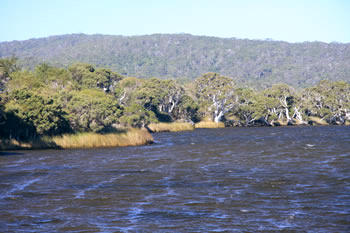
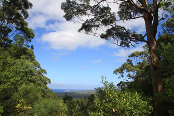
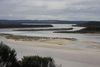
Filled by the Walpole River and Collier Creek, the dark waters of the Walpole Inlet empty into the Nornalup Inlet through the Channels. The Channels offer a spectacular view over both inlets and can be easily accessed by taking The Knoll Scenic Drive.
The Walpole Inlet is easily accessed from the town of Walpole, which has a large visitors centre where you can get lots of useful information from the friendly staff about the Natural Attractions of the Walpole Wilderness Area.
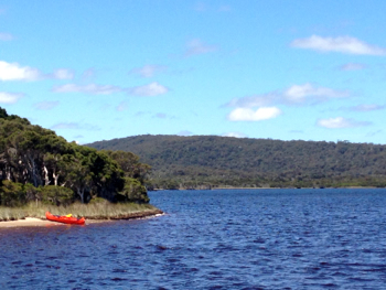
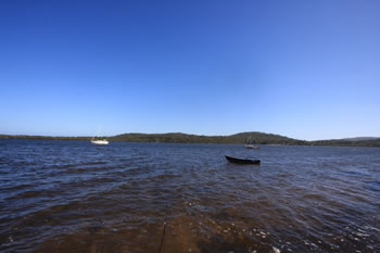
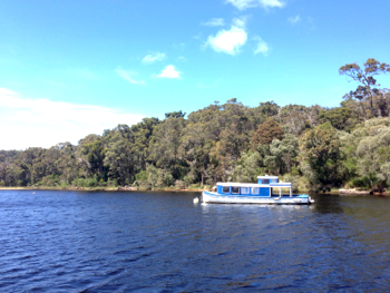
Canoeing and Kayaking are popular recreational activities on the Walpole Inlet.
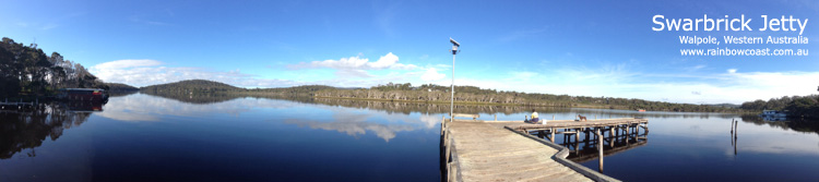
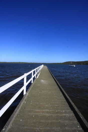
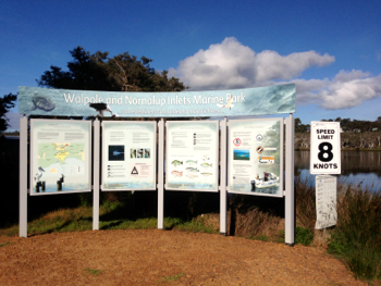
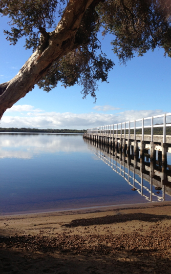
Swarbrick Jetty is located directly south of Walpole Town and is one of the two authorised boat launches along the Walpole Inlet.
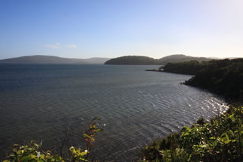
Popular with fishermen and visitors to the Walpole Region, the Swarbrick Jetty gives impressive views across the Walpole Inlet.
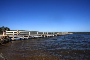
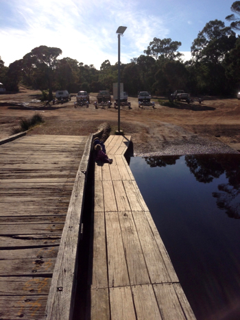
There is a boat launching area beside the Swarbrick Jetty in Walpole. Boats are required to follow the regulations signposted. For information contact the Walpole Visitors Centre in Walpole Town Centre.
There is also a very informative informational resource board at the Swarbrick Jetty on the Walpole Inlet which shares some of the geography and wildlife information about the Inlet.
This is a great place to stop and have a picnic if you're looking for a relaxing place by the water in Walpole.
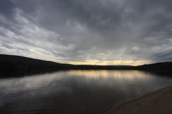
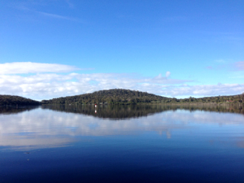
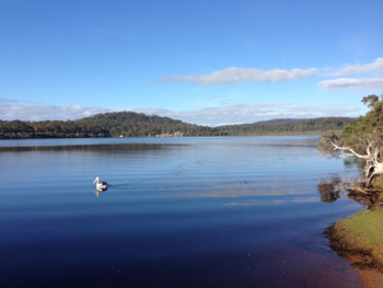
On a still day the waters of the Walpole Inlet are beautifully reflective. On other days, it can feel like the edge of the world with non-stop fresh wind from the south west. Like everywere along the Rainbow Coast, the weather is changeable. :)
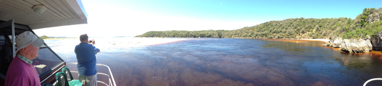
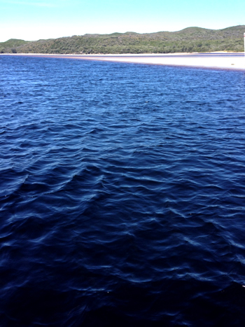
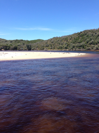
The dark waters of the Walpole Inlet provide a habitat to many creatures. The tanin in the water creates an almost impenetrable indigo colour. Beautiful!
The Knoll Scenic Drive Map
Tap the markers for information about the locations on the Map below.
What's on the map? These are the locations plotted above:
 Knoll Scenic Drive
 A five kilometre circular drive on the peninsula between the Walpole and Nornalup Inlets. A distinctly well-kept rest area with picnic tables & toilets. Visit Knoll Scenic Drive
Walpole and surrounds:
 Walpole Town
 At the northern edge of the Walpole Inlet, Walpole is one of the few towns on the path of the Bibbulmun Track. Visit Walpole Town
 Walpole Regional Map
 Map of the Walpole Region including places to visit and National Parks. Visit Walpole Regional Map
Knoll Scenic Drive A five kilometre circular drive on the peninsula between the Walpole and Nornalup Inlets. A distinctly well-kept rest area with picnic tables & toilets. Visit Knoll Scenic Drive
 Stay in Walpole
 An inspiring selection of quality accommodation of all types. Friendly service. Choose from a variety of great accommodation in and around Walpole, WA. Find Accommodation in Walpole! Visit Stay in Walpole
Other attractions in the Walpole-Nornalup National Park:
 Walpole-Nornalup National Park
 Expansive covering over twenty thousand hectares of the Walpole Wilderness Area. Visit Walpole-Nornalup National Park
Walpole Town At the northern edge of the Walpole Inlet, Walpole is one of the few towns on the path of the Bibbulmun Track. Visit Walpole Town
 Ancient Empires Walk
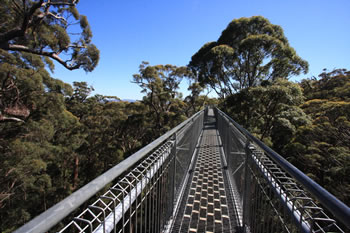
 The Ancient Empires Walk takes you through the forest at the base of the Giant Tingle Trees at the Treetop Walk. Visit Ancient Empires Walk
 Circular Pool
 Family friendly swirling pools. Access via steps or a gentle paved pathway. Viewing platforms close to carpark. Visit Circular Pool
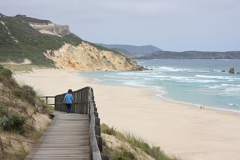
 Conspicuous Cliff
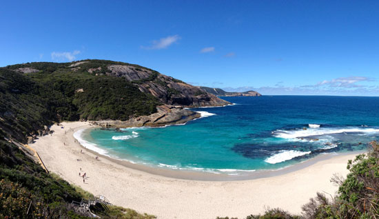
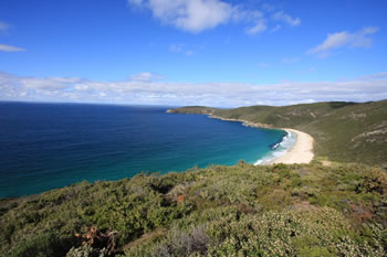
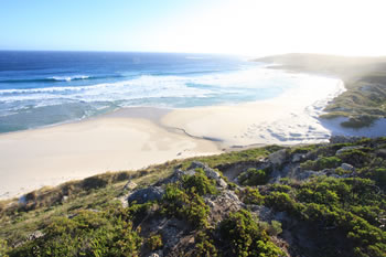
 Standing high above the surrounding heathland, the Cliff-top lookout gives fantastic views of the beach and river flowing into the sea. Visit Conspicuous Cliff
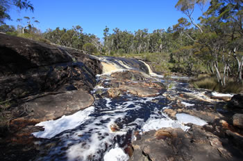 Fernhook Falls
 Located along the Deep River Fernhook Falls is a popular swimming and picnic spot in summer, and during winter is a truly magnificent sight! Visit Fernhook Falls
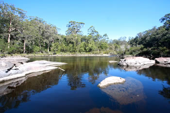
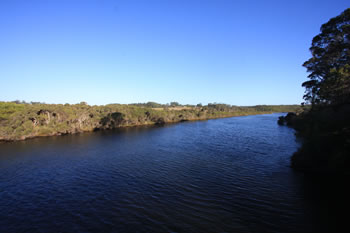 Frankland River
 The Frankland River is the 8th largest in the state of Western Australia flowing into the Nornalup Inlet. Visit Frankland River
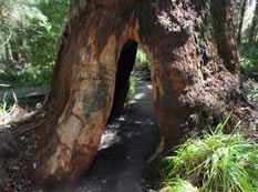
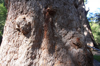 Giant Tingle Tree
 This Giant Tingle Tree is special because it the oldest living eucalypt in the world. It is an 800 metre walk from the car park to the Giant Tingle and back. Visit Giant Tingle Tree
 Hilltop Lookout
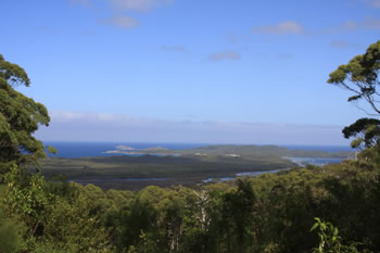
 On Hilltop Road, east of Walpole. Overlooking the Nornalup Inlet and Frankland River. Rocky Head and Saddle Island can be seen in the distance. Visit Hilltop Lookout
 Irwin Inlet
 Irwin Inlet carves the sandbars at Peaceful Bay due to the swift flow into the Southern Ocean. Visit Irwin Inlet
Knoll Scenic Drive A five kilometre circular drive on the peninsula between the Walpole and Nornalup Inlets. A distinctly well-kept rest area with picnic tables & toilets. Visit Knoll Scenic Drive
 Mandalay Beach
 Spectacular views to Chatham Island, gorgeous white sandy beach it is a must-see... sometimes the shipwreck is visible too. Visit Mandalay Beach
 Nornalup Inlet
 The Nornalup Inlet is serene. Fed from the Deep and Frankland Rivers it connects to the Walpole Inlet via a natural deep water channel. Visit Nornalup Inlet
 Peaceful Bay
 Peaceful Bay beach is split in two by the Irwin Inlet as it discharges into the ocean. Sand dunes abound. Visit Peaceful Bay
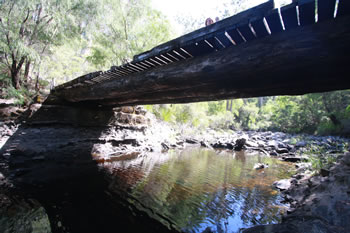 Sappers Bridge
 Re-built October 1982 for the National Parks Authority by 22nd Construction Squadron RAE following flood damage January 1982. Visit Sappers Bridge
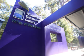 Valley of the Giants
 The Valley of the Giants Wilderness Discovery Centre at the Treetop Walk is the most visited place on the Rainbow Coast. Visit Valley of the Giants
Walpole Inlet Filled by the Deep & Frankland Rivers, the dark waters of the Walpole Inlet empty into the Nornalup Inlet through the Channels. Visit Walpole Inlet
Accommodation in Walpole?


Other amazing locations in the South-West of Western Australia!
More information on the south-west coast in our other Western Australian travellers guides:
Albany Tourist Information:
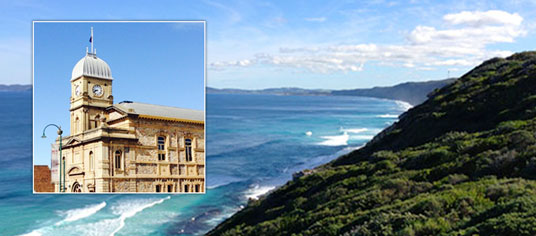
Albany WA
The Albany is the oldest settlement in Western Australia. Filled with history, surrounded by beaches and waterways, and a great place to visit while on holiday on the south coast of WA. Visit Albany today.
Have you visited?
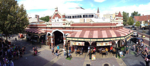
Fremantle WA
Fremantle, the Port City, is located south-west of Perth at the mouth of the Swan River. Fremantle's vibrant nightlife, music scene and cafe' culture make Fremantle a perfect getaway from the bustle of Perth. Beaches, history, shopping, dining out, and more. VISIT FREMANTLE
Have you visited?
Margaret River, WA
The Margaret River Region is an area of magnificent beauty on the western coast of the south west of WA. From the expansive shores of Busselton on Geographe Bay, through Dunsborough & Margaret River to Augusta, the Margaret River Region is fantastic. VISIT MARGARET RIVER
Have you visited?
Denmark WA
Denmark WA is one of the most beautiful places along the south coast as it has forests, beaches, rivers and waves. Everything you need for the perfect south coast holiday. Denmark Wineries are popular too! Info on Denmark Town including shopping, dining & history, VISIT DENMARK WA